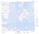
Maps showing Red Rocks, Newfoundland and Labrador
Red Rocks is a Shoal located in Newfoundland and Labrador and has an elevation of 0 meters.
- Latitude: 56° 41' 24'' North (decimal: 56.6900732)
- Longitude: 61° 11' 22'' West (decimal: -61.1893311)
- Topography Feature Category: Shoal
- Geographical Feature: Rocks
- Canadian Province/Territory: Newfoundland and Labrador
- Elevation: 0 meters
- Atlas of Canada Locator Map: Red Rocks
- GPS Coordinate Locator Map: Red Rocks Lat/Long