Maps showing The Tall Bride, Torngat Mountains, Newfoundland and Labrador
The Tall Bride is a Falls located in Torngat Mountains, Newfoundland and Labrador.
- Latitude: 59° 4' 1'' North (decimal: 59.0669444)
- Longitude: 63° 48' 57'' West (decimal: -63.8158333)
- Topography Feature Category: Falls
- Geographical Feature: Waterfall
- Canadian Province/Territory: Newfoundland and Labrador
- Location: Torngat Mountains
- Atlas of Canada Locator Map: The Tall Bride
- GPS Coordinate Locator Map: The Tall Bride Lat/Long
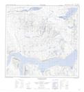
The Tall Bride NTS Map Sheets