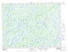
Maps showing Spruce Brook, Burgeo-Bay d'Espoir, Newfoundland and Labrador
Spruce Brook is a River located in Burgeo-Bay d'Espoir, Newfoundland and Labrador and has an elevation of 173 meters.
- Latitude: 48° 19' 57'' North (decimal: 48.3325000)
- Longitude: 55° 46' 29'' West (decimal: -55.7747222)
- Topography Feature Category: River
- Geographical Feature: Brook
- Canadian Province/Territory: Newfoundland and Labrador
- Elevation: 173 meters
- Location: Burgeo-Bay d'Espoir
- Atlas of Canada Locator Map: Spruce Brook
- GPS Coordinate Locator Map: Spruce Brook Lat/Long
Spruce Brook NTS Map Sheets