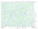
Maps showing Burnt Hill Steady, Burgeo-Bay d'Espoir, Newfoundland and Labrador
Burnt Hill Steady is a Lake located in Burgeo-Bay d'Espoir, Newfoundland and Labrador and has an elevation of 179 meters.
- Latitude: 48° 20' 34'' North (decimal: 48.3427777)
- Longitude: 55° 45' 18'' West (decimal: -55.7550000)
- Topography Feature Category: Lake
- Geographical Feature: Steady
- Canadian Province/Territory: Newfoundland and Labrador
- Elevation: 179 meters
- Location: Burgeo-Bay d'Espoir
- Atlas of Canada Locator Map: Burnt Hill Steady
- GPS Coordinate Locator Map: Burnt Hill Steady Lat/Long
Burnt Hill Steady NTS Map Sheets