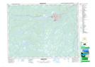
Maps showing Beothuck Provincial Park, Windsor-Buchans, Newfoundland and Labrador
Beothuck Provincial Park is a Conservation area located in Windsor-Buchans, Newfoundland and Labrador and has an elevation of 71 meters.
- Latitude: 48° 57' 00'' North (decimal: 48.9499999)
- Longitude: 55° 42' 57'' West (decimal: -55.7158333)
- Topography Feature Category: Conservation area
- Geographical Feature: Provincial Park
- Canadian Province/Territory: Newfoundland and Labrador
- Elevation: 71 meters
- Location: Windsor-Buchans
- GPS Coordinate Locator Map: Beothuck Provincial Park Lat/Long
Beothuck Provincial Park NTS Map Sheets