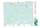
Maps showing Glenwood Provincial Park, Gander, Newfoundland and Labrador
Glenwood Provincial Park is a Conservation area located in Gander, Newfoundland and Labrador and has an elevation of 83 meters.
- Latitude: 48° 57' 31'' North (decimal: 48.9586111)
- Longitude: 54° 49' 27'' West (decimal: -54.8241666)
- Topography Feature Category: Conservation area
- Geographical Feature: Provincial Park
- Canadian Province/Territory: Newfoundland and Labrador
- Elevation: 83 meters
- Location: Gander
- GPS Coordinate Locator Map: Glenwood Provincial Park Lat/Long