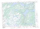
Maps showing Pitt's Pond Provincial Park, Terra Nova, Newfoundland and Labrador
Pitt's Pond Provincial Park is a Conservation area located in Terra Nova, Newfoundland and Labrador and has an elevation of 106 meters.
- Latitude: 48° 28' 00'' North (decimal: 48.4666666)
- Longitude: 54° 10' 57'' West (decimal: -54.1825000)
- Topography Feature Category: Conservation area
- Geographical Feature: Provincial Park
- Canadian Province/Territory: Newfoundland and Labrador
- Elevation: 106 meters
- Location: Terra Nova
- GPS Coordinate Locator Map: Pitt's Pond Provincial Park Lat/Long
Pitt's Pond Provincial Park NTS Map Sheets