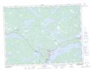
Maps showing Square Pond Provincial Park, Bonavista North, Newfoundland and Labrador
Square Pond Provincial Park is a Conservation area located in Bonavista North, Newfoundland and Labrador and has an elevation of 41 meters.
- Latitude: 48° 47' 00'' North (decimal: 48.7833333)
- Longitude: 54° 17' 57'' West (decimal: -54.2991666)
- Topography Feature Category: Conservation area
- Geographical Feature: Provincial Park
- Canadian Province/Territory: Newfoundland and Labrador
- Elevation: 41 meters
- Location: Bonavista North
- GPS Coordinate Locator Map: Square Pond Provincial Park Lat/Long