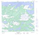
Maps showing Toma Island, Torngat Mountains, Newfoundland and Labrador
Toma Island is a Island located in Torngat Mountains, Newfoundland and Labrador.
- Latitude: 56° 13' 20'' North (decimal: 56.2222222)
- Longitude: 61° 58' 23'' West (decimal: -61.9730555)
- Topography Feature Category: Island
- Geographical Feature: Island
- Canadian Province/Territory: Newfoundland and Labrador
- Location: Torngat Mountains
- Atlas of Canada Locator Map: Toma Island
- GPS Coordinate Locator Map: Toma Island Lat/Long