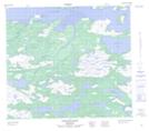
Maps showing Otter Brook, Torngat Mountains, Newfoundland and Labrador
Otter Brook is a River located in Torngat Mountains, Newfoundland and Labrador.
- Latitude: 56° 11' 32'' North (decimal: 56.1922222)
- Longitude: 61° 47' 17'' West (decimal: -61.7880555)
- Topography Feature Category: River
- Geographical Feature: Brook
- Canadian Province/Territory: Newfoundland and Labrador
- Location: Torngat Mountains
- Atlas of Canada Locator Map: Otter Brook
- GPS Coordinate Locator Map: Otter Brook Lat/Long