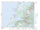
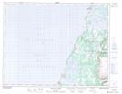
Maps showing Three Mile Rock, St. Barbe, Newfoundland and Labrador
Three Mile Rock is a Unincorporated area located in St. Barbe, Newfoundland and Labrador and has an elevation of 44 meters.
- Latitude: 50° 0' 20'' North (decimal: 50.0055555)
- Longitude: 57° 44' 9'' West (decimal: -57.7358333)
- Topography Feature Category: Unincorporated area
- Geographical Feature: Settlement
- Canadian Province/Territory: Newfoundland and Labrador
- Elevation: 44 meters
- Location: St. Barbe
- Atlas of Canada Locator Map: Three Mile Rock
- GPS Coordinate Locator Map: Three Mile Rock Lat/Long
Three Mile Rock NTS Map Sheets