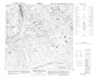
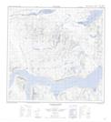
Maps showing Ivitab Konga River, Torngat Mountains, Newfoundland and Labrador
Ivitab Konga River is a River located in Torngat Mountains, Newfoundland and Labrador.
- Latitude: 59° 0' 40'' North (decimal: 59.0110626)
- Longitude: 63° 44' 40'' West (decimal: -63.7444736)
- Topography Feature Category: River
- Geographical Feature: River
- Canadian Province/Territory: Newfoundland and Labrador
- Location: Torngat Mountains
- Atlas of Canada Locator Map: Ivitab Konga River
- GPS Coordinate Locator Map: Ivitab Konga River Lat/Long
Ivitab Konga River NTS Map Sheets