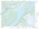
Maps showing Bugging Hole, Humber Valley, Newfoundland and Labrador
Bugging Hole is a Lake located in Humber Valley, Newfoundland and Labrador and has an elevation of 81 meters.
- Latitude: 49° 11' 19'' North (decimal: 49.1886111)
- Longitude: 57° 17' 26'' West (decimal: -57.2905555)
- Topography Feature Category: Lake
- Geographical Feature: Pond
- Canadian Province/Territory: Newfoundland and Labrador
- Elevation: 81 meters
- Location: Humber Valley
- Atlas of Canada Locator Map: Bugging Hole
- GPS Coordinate Locator Map: Bugging Hole Lat/Long
Bugging Hole NTS Map Sheets