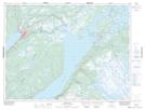
Maps showing Hicks Cove, Humber Valley, Newfoundland and Labrador
Hicks Cove is a Bay located in Humber Valley, Newfoundland and Labrador and has an elevation of 78 meters.
- Latitude: 49° 10' 51'' North (decimal: 49.1808333)
- Longitude: 57° 16' 26'' West (decimal: -57.2738888)
- Topography Feature Category: Bay
- Geographical Feature: Cove
- Canadian Province/Territory: Newfoundland and Labrador
- Elevation: 78 meters
- Location: Humber Valley
- Atlas of Canada Locator Map: Hicks Cove
- GPS Coordinate Locator Map: Hicks Cove Lat/Long
Hicks Cove NTS Map Sheets