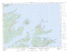
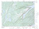
Maps showing Jackson's Cove-Langdon's Cove-Silverdale, Green Bay, Newfoundland and Labrador
Jackson's Cove-Langdon's Cove-Silverdale is a Unincorporated area located in Green Bay, Newfoundland and Labrador.
- Latitude: 49° 41' 11'' North (decimal: 49.6863888)
- Longitude: 55° 59' 34'' West (decimal: -55.9927777)
- Topography Feature Category: Unincorporated area
- Geographical Feature: Local Service District
- Canadian Province/Territory: Newfoundland and Labrador
- Location: Green Bay
- Atlas of Canada Locator Map: Jackson's Cove-Langdon's Cove-Silverdale
- GPS Coordinate Locator Map: Jackson's Cove-Langdon's Cove-Silverdale Lat/Long
Jackson's Cove-Langdon's Cove-Silverdale NTS Map Sheets