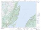
Maps showing Round Pond, Humber Valley, Newfoundland and Labrador
Round Pond is a Lake located in Humber Valley, Newfoundland and Labrador and has an elevation of 183 meters.
- Latitude: 49° 49' 36'' North (decimal: 49.8266666)
- Longitude: 56° 50' 49'' West (decimal: -56.8469444)
- Topography Feature Category: Lake
- Geographical Feature: Pond
- Canadian Province/Territory: Newfoundland and Labrador
- Elevation: 183 meters
- Location: Humber Valley
- Atlas of Canada Locator Map: Round Pond
- GPS Coordinate Locator Map: Round Pond Lat/Long
Round Pond NTS Map Sheets