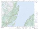
Maps showing Devils Dressing Place, Humber Valley, Newfoundland and Labrador
Devils Dressing Place is a Mountain located in Humber Valley, Newfoundland and Labrador and has an elevation of 273 meters.
- Latitude: 49° 46' 8'' North (decimal: 49.7688888)
- Longitude: 56° 56' 11'' West (decimal: -56.9363888)
- Topography Feature Category: Mountain
- Geographical Feature: Hill
- Canadian Province/Territory: Newfoundland and Labrador
- Elevation: 273 meters
- Location: Humber Valley
- Atlas of Canada Locator Map: Devils Dressing Place
- GPS Coordinate Locator Map: Devils Dressing Place Lat/Long
Devils Dressing Place NTS Map Sheets