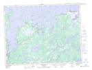
Maps showing Musgrave Harbour-Doting Cove, Newfoundland and Labrador
Musgrave Harbour-Doting Cove is a Other municipal/district area - miscellaneous located in Newfoundland and Labrador.
- Latitude: 49° 27' 0'' North (decimal: 49.4500000)
- Longitude: 53° 57' 57'' West (decimal: -53.9658333)
- Topography Feature Category: Other municipal/district area - miscellaneous
- Geographical Feature: Rural District
- Canadian Province/Territory: Newfoundland and Labrador
- GPS Coordinate Locator Map: Musgrave Harbour-Doting Cove Lat/Long
Musgrave Harbour-Doting Cove NTS Map Sheets