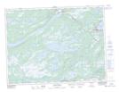
Maps showing Tunnel Pond, Terra Nova, Newfoundland and Labrador
Tunnel Pond is a Lake located in Terra Nova, Newfoundland and Labrador.
- Latitude: 48° 35' 25'' North (decimal: 48.5902777)
- Longitude: 54° 9' 4'' West (decimal: -54.1511111)
- Topography Feature Category: Lake
- Geographical Feature: Pond
- Canadian Province/Territory: Newfoundland and Labrador
- Location: Terra Nova
- Atlas of Canada Locator Map: Tunnel Pond
- GPS Coordinate Locator Map: Tunnel Pond Lat/Long
Tunnel Pond NTS Map Sheets