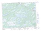
Maps showing Saunders Brook, Terra Nova, Newfoundland and Labrador
Saunders Brook is a River located in Terra Nova, Newfoundland and Labrador.
- Latitude: 48° 30' 40'' North (decimal: 48.5111111)
- Longitude: 54° 24' 45'' West (decimal: -54.4125000)
- Topography Feature Category: River
- Geographical Feature: Brook
- Canadian Province/Territory: Newfoundland and Labrador
- Location: Terra Nova
- Atlas of Canada Locator Map: Saunders Brook
- GPS Coordinate Locator Map: Saunders Brook Lat/Long
Saunders Brook NTS Map Sheets