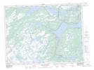
Maps showing Third Shute Steady, Terra Nova, Newfoundland and Labrador
Third Shute Steady is a Lake located in Terra Nova, Newfoundland and Labrador.
- Latitude: 48° 18' 41'' North (decimal: 48.3113888)
- Longitude: 54° 6' 49'' West (decimal: -54.1136111)
- Topography Feature Category: Lake
- Geographical Feature: Steady
- Canadian Province/Territory: Newfoundland and Labrador
- Location: Terra Nova
- Atlas of Canada Locator Map: Third Shute Steady
- GPS Coordinate Locator Map: Third Shute Steady Lat/Long
Third Shute Steady NTS Map Sheets