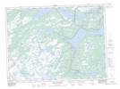
Maps showing The Feeder, Trinity North, Newfoundland and Labrador
The Feeder is a Lake located in Trinity North, Newfoundland and Labrador.
- Latitude: 48° 15' 5'' North (decimal: 48.2513888)
- Longitude: 54° 23' 12'' West (decimal: -54.3866666)
- Topography Feature Category: Lake
- Geographical Feature: Gully
- Canadian Province/Territory: Newfoundland and Labrador
- Location: Trinity North
- Atlas of Canada Locator Map: The Feeder
- GPS Coordinate Locator Map: The Feeder Lat/Long
The Feeder NTS Map Sheets