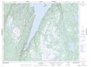
Maps showing The Beaches, Humber Valley, Newfoundland and Labrador
The Beaches is a Unincorporated area located in Humber Valley, Newfoundland and Labrador and has an elevation of 46 meters.
- Latitude: 49° 34' 29'' North (decimal: 49.5747221)
- Longitude: 56° 49' 39'' West (decimal: -56.8275)
- Topography Feature Category: Unincorporated area
- Geographical Feature: Settlement
- Canadian Province/Territory: Newfoundland and Labrador
- Elevation: 46 meters
- Location: Humber Valley
- Atlas of Canada Locator Map: The Beaches
- GPS Coordinate Locator Map: The Beaches Lat/Long