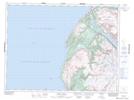
Maps showing Grassy Point Brook, St. Barbe, Newfoundland and Labrador
Grassy Point Brook is a River located in St. Barbe, Newfoundland and Labrador and has an elevation of 79 meters.
- Latitude: 49° 23' 37'' North (decimal: 49.3936111)
- Longitude: 58° 0' 17'' West (decimal: -58.0047222)
- Topography Feature Category: River
- Geographical Feature: Brook
- Canadian Province/Territory: Newfoundland and Labrador
- Elevation: 79 meters
- Location: St. Barbe
- Atlas of Canada Locator Map: Grassy Point Brook
- GPS Coordinate Locator Map: Grassy Point Brook Lat/Long
Grassy Point Brook NTS Map Sheets