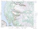
Maps showing Middle Camp Pond, St. Barbe, Newfoundland and Labrador
Middle Camp Pond is a Lake located in St. Barbe, Newfoundland and Labrador.
- Latitude: 49° 42' 50'' North (decimal: 49.7138888)
- Longitude: 57° 30' 37'' West (decimal: -57.5102777)
- Topography Feature Category: Lake
- Geographical Feature: Pond
- Canadian Province/Territory: Newfoundland and Labrador
- Location: St. Barbe
- Atlas of Canada Locator Map: Middle Camp Pond
- GPS Coordinate Locator Map: Middle Camp Pond Lat/Long
Middle Camp Pond NTS Map Sheets