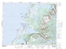
Maps showing Jim Vincents Lookout, St. Barbe, Newfoundland and Labrador
Jim Vincents Lookout is a Mountain located in St. Barbe, Newfoundland and Labrador and has an elevation of 503 meters.
- Latitude: 49° 53' 12'' North (decimal: 49.8866666)
- Longitude: 57° 36' 42'' West (decimal: -57.6116666)
- Topography Feature Category: Mountain
- Geographical Feature: Lookout
- Canadian Province/Territory: Newfoundland and Labrador
- Elevation: 503 meters
- Location: St. Barbe
- Atlas of Canada Locator Map: Jim Vincents Lookout
- GPS Coordinate Locator Map: Jim Vincents Lookout Lat/Long
Jim Vincents Lookout NTS Map Sheets