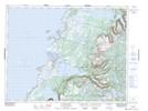
Maps showing The Elephant, St. Barbe, Newfoundland and Labrador
The Elephant is a Mountain located in St. Barbe, Newfoundland and Labrador and has an elevation of 491 meters.
- Latitude: 49° 54' 22'' North (decimal: 49.9061111)
- Longitude: 57° 33' 51'' West (decimal: -57.5641666)
- Topography Feature Category: Mountain
- Geographical Feature: Hill
- Canadian Province/Territory: Newfoundland and Labrador
- Elevation: 491 meters
- Location: St. Barbe
- Atlas of Canada Locator Map: The Elephant
- GPS Coordinate Locator Map: The Elephant Lat/Long
The Elephant NTS Map Sheets