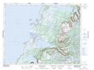
Maps showing The Crossing Place, St. Barbe, Newfoundland and Labrador
The Crossing Place is a Plain located in St. Barbe, Newfoundland and Labrador and has an elevation of 535 meters.
- Latitude: 49° 52' 15'' North (decimal: 49.8708333)
- Longitude: 57° 35' 27'' West (decimal: -57.5908333)
- Topography Feature Category: Plain
- Geographical Feature: Crossing Place
- Canadian Province/Territory: Newfoundland and Labrador
- Elevation: 535 meters
- Location: St. Barbe
- Atlas of Canada Locator Map: The Crossing Place
- GPS Coordinate Locator Map: The Crossing Place Lat/Long
The Crossing Place NTS Map Sheets