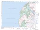
Maps showing Crollys Brook Pond, St. Barbe, Newfoundland and Labrador
Crollys Brook Pond is a Lake located in St. Barbe, Newfoundland and Labrador and has an elevation of 314 meters.
- Latitude: 49° 29' 38'' North (decimal: 49.4938888)
- Longitude: 57° 59' 16'' West (decimal: -57.9877777)
- Topography Feature Category: Lake
- Geographical Feature: Pond
- Canadian Province/Territory: Newfoundland and Labrador
- Elevation: 314 meters
- Location: St. Barbe
- Atlas of Canada Locator Map: Crollys Brook Pond
- GPS Coordinate Locator Map: Crollys Brook Pond Lat/Long
Crollys Brook Pond NTS Map Sheets