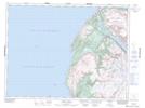
Maps showing Trout River Big Pond, St. Barbe, Newfoundland and Labrador
Trout River Big Pond is a Lake located in St. Barbe, Newfoundland and Labrador and has an elevation of 25 meters.
- Latitude: 49° 24' 19'' North (decimal: 49.4052778)
- Longitude: 58° 2' 11'' West (decimal: -58.0363888)
- Topography Feature Category: Lake
- Geographical Feature: Pond
- Canadian Province/Territory: Newfoundland and Labrador
- Elevation: 25 meters
- Location: St. Barbe
- Atlas of Canada Locator Map: Trout River Big Pond
- GPS Coordinate Locator Map: Trout River Big Pond Lat/Long
Trout River Big Pond NTS Map Sheets