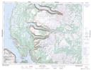
Maps showing Lookout Hills, St. Barbe, Newfoundland and Labrador
Lookout Hills is a Mountain located in St. Barbe, Newfoundland and Labrador.
- Latitude: 49° 33' 00'' North (decimal: 49.5499999)
- Longitude: 57° 56' 57'' West (decimal: -57.9492000)
- Topography Feature Category: Mountain
- Geographical Feature: Hills
- Canadian Province/Territory: Newfoundland and Labrador
- Location: St. Barbe
- Atlas of Canada Locator Map: Lookout Hills
- GPS Coordinate Locator Map: Lookout Hills Lat/Long
Lookout Hills NTS Map Sheets