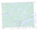
Maps showing Benmans Island, Newfoundland and Labrador
Benmans Island is a Island located in Newfoundland and Labrador.
- Latitude: 48° 49' 0'' North (decimal: 48.8166999)
- Longitude: 54° 2' 57'' West (decimal: -54.0492000)
- Topography Feature Category: Island
- Geographical Feature: Island
- Canadian Province/Territory: Newfoundland and Labrador
- Atlas of Canada Locator Map: Benmans Island
- GPS Coordinate Locator Map: Benmans Island Lat/Long