Maps showing Lees Bog, Bonavista North, Newfoundland and Labrador
Lees Bog is a Low vegetation located in Bonavista North, Newfoundland and Labrador.
- Latitude: 48° 57' 48'' North (decimal: 48.9633333)
- Longitude: 54° 6' 44'' West (decimal: -54.1122222)
- Topography Feature Category: Low vegetation
- Geographical Feature: Bog
- Canadian Province/Territory: Newfoundland and Labrador
- Location: Bonavista North
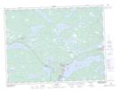
- Atlas of Canada Locator Map: Lees Bog
- GPS Coordinate Locator Map: Lees Bog Lat/Long