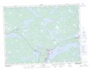
Maps showing Lockers Bay Brook, Bonavista North, Newfoundland and Labrador
Lockers Bay Brook is a River located in Bonavista North, Newfoundland and Labrador.
- Latitude: 48° 54' 5'' North (decimal: 48.9013888)
- Longitude: 54° 0' 22'' West (decimal: -54.0061111)
- Topography Feature Category: River
- Geographical Feature: Brook
- Canadian Province/Territory: Newfoundland and Labrador
- Location: Bonavista North
- Atlas of Canada Locator Map: Lockers Bay Brook
- GPS Coordinate Locator Map: Lockers Bay Brook Lat/Long