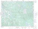
Maps showing Burnt Hill Lakes, Newfoundland and Labrador
Burnt Hill Lakes is a Lake located in Newfoundland and Labrador.
- Latitude: 49° 39' 11'' North (decimal: 49.6530699)
- Longitude: 57° 22' 47'' West (decimal: -57.3796298)
- Topography Feature Category: Lake
- Geographical Feature: Lakes
- Canadian Province/Territory: Newfoundland and Labrador
- Atlas of Canada Locator Map: Burnt Hill Lakes
- GPS Coordinate Locator Map: Burnt Hill Lakes Lat/Long
Burnt Hill Lakes NTS Map Sheets