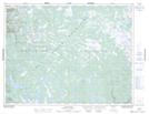
Maps showing Beaver Brook, Newfoundland and Labrador
Beaver Brook is a River located in Newfoundland and Labrador.
- Latitude: 49° 59' 40'' North (decimal: 49.9944998)
- Longitude: 57° 3' 48'' West (decimal: -57.0632800)
- Topography Feature Category: River
- Geographical Feature: Brook
- Canadian Province/Territory: Newfoundland and Labrador
- Atlas of Canada Locator Map: Beaver Brook
- GPS Coordinate Locator Map: Beaver Brook Lat/Long
Beaver Brook NTS Map Sheets