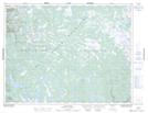
Maps showing Long Hill, Newfoundland and Labrador
Long Hill is a Mountain located in Newfoundland and Labrador.
- Latitude: 49° 59' 48'' North (decimal: 49.9966598)
- Longitude: 57° 22' 13'' West (decimal: -57.3701499)
- Topography Feature Category: Mountain
- Geographical Feature: Hill
- Canadian Province/Territory: Newfoundland and Labrador
- Atlas of Canada Locator Map: Long Hill
- GPS Coordinate Locator Map: Long Hill Lat/Long
Long Hill NTS Map Sheets