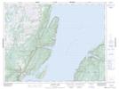
Maps showing Devils Dressing Notch, Newfoundland and Labrador
Devils Dressing Notch is a Mountain located in Newfoundland and Labrador.
- Latitude: 49° 45' 50'' North (decimal: 49.7639200)
- Longitude: 56° 56' 32'' West (decimal: -56.9420900)
- Topography Feature Category: Mountain
- Geographical Feature: Ridge
- Canadian Province/Territory: Newfoundland and Labrador
- Atlas of Canada Locator Map: Devils Dressing Notch
- GPS Coordinate Locator Map: Devils Dressing Notch Lat/Long
Devils Dressing Notch NTS Map Sheets