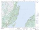
Maps showing Salmon-House Point, Newfoundland and Labrador
Salmon-House Point is a Cape located in Newfoundland and Labrador.
- Latitude: 49° 46' 1'' North (decimal: 49.7668898)
- Longitude: 56° 53' 41'' West (decimal: -56.8948398)
- Topography Feature Category: Cape
- Geographical Feature: Point
- Canadian Province/Territory: Newfoundland and Labrador
- Atlas of Canada Locator Map: Salmon-House Point
- GPS Coordinate Locator Map: Salmon-House Point Lat/Long
Salmon-House Point NTS Map Sheets