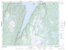
Maps showing Downs Pond, Newfoundland and Labrador
Downs Pond is a Lake located in Newfoundland and Labrador.
- Latitude: 49° 33' 57'' North (decimal: 49.5658898)
- Longitude: 56° 42' 45'' West (decimal: -56.7125099)
- Topography Feature Category: Lake
- Geographical Feature: Pond
- Canadian Province/Territory: Newfoundland and Labrador
- Atlas of Canada Locator Map: Downs Pond
- GPS Coordinate Locator Map: Downs Pond Lat/Long