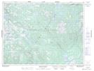
Maps showing Deer Pond, Newfoundland and Labrador
Deer Pond is a Lake located in Newfoundland and Labrador.
- Latitude: 49° 38' 59'' North (decimal: 49.6496598)
- Longitude: 57° 1' 46'' West (decimal: -57.0294999)
- Topography Feature Category: Lake
- Geographical Feature: Pond
- Canadian Province/Territory: Newfoundland and Labrador
- Atlas of Canada Locator Map: Deer Pond
- GPS Coordinate Locator Map: Deer Pond Lat/Long
Deer Pond NTS Map Sheets