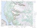
Maps showing Jesse Abes Pond, Newfoundland and Labrador
Jesse Abes Pond is a Lake located in Newfoundland and Labrador.
- Latitude: 49° 30' 50'' North (decimal: 49.5139599)
- Longitude: 57° 32' 59'' West (decimal: -57.5498298)
- Topography Feature Category: Lake
- Geographical Feature: Pond
- Canadian Province/Territory: Newfoundland and Labrador
- Atlas of Canada Locator Map: Jesse Abes Pond
- GPS Coordinate Locator Map: Jesse Abes Pond Lat/Long
Jesse Abes Pond NTS Map Sheets