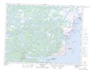
Maps showing Shoal Arm Pond, Newfoundland and Labrador
Shoal Arm Pond is a Lake located in Newfoundland and Labrador.
- Latitude: 49° 13' 53'' North (decimal: 49.2313888)
- Longitude: 53° 32' 7'' West (decimal: -53.5352777)
- Topography Feature Category: Lake
- Geographical Feature: Pond
- Canadian Province/Territory: Newfoundland and Labrador
- Atlas of Canada Locator Map: Shoal Arm Pond
- GPS Coordinate Locator Map: Shoal Arm Pond Lat/Long
Shoal Arm Pond NTS Map Sheets