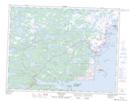
Maps showing Aunt Marys Island, Newfoundland and Labrador
Aunt Marys Island is a Island located in Newfoundland and Labrador.
- Latitude: 49° 0' 20'' North (decimal: 49.0055555)
- Longitude: 53° 43' 49'' West (decimal: -53.7302777)
- Topography Feature Category: Island
- Geographical Feature: Island
- Canadian Province/Territory: Newfoundland and Labrador
- Atlas of Canada Locator Map: Aunt Marys Island
- GPS Coordinate Locator Map: Aunt Marys Island Lat/Long
Aunt Marys Island NTS Map Sheets