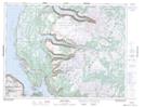
Maps showing Shoal Point, Newfoundland and Labrador
Shoal Point is a Cape located in Newfoundland and Labrador.
- Latitude: 49° 31' 27'' North (decimal: 49.5242)
- Longitude: 57° 52' 4'' West (decimal: -57.8677998)
- Topography Feature Category: Cape
- Geographical Feature: Point
- Canadian Province/Territory: Newfoundland and Labrador
- Atlas of Canada Locator Map: Shoal Point
- GPS Coordinate Locator Map: Shoal Point Lat/Long
Shoal Point NTS Map Sheets