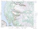
Maps showing Sparkes Gulch, Newfoundland and Labrador
Sparkes Gulch is a River located in Newfoundland and Labrador.
- Latitude: 49° 39' 59'' North (decimal: 49.6663888)
- Longitude: 57° 45' 28'' West (decimal: -57.7577776)
- Topography Feature Category: River
- Geographical Feature: Gulch
- Canadian Province/Territory: Newfoundland and Labrador
- Atlas of Canada Locator Map: Sparkes Gulch
- GPS Coordinate Locator Map: Sparkes Gulch Lat/Long
Sparkes Gulch NTS Map Sheets