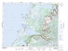
Maps showing Big Mish, Newfoundland and Labrador
Big Mish is a Low vegetation located in Newfoundland and Labrador.
- Latitude: 49° 46' 20'' North (decimal: 49.7722221)
- Longitude: 57° 42' 33'' West (decimal: -57.7091665)
- Topography Feature Category: Low vegetation
- Geographical Feature: Bog
- Canadian Province/Territory: Newfoundland and Labrador
- Atlas of Canada Locator Map: Big Mish
- GPS Coordinate Locator Map: Big Mish Lat/Long
Big Mish NTS Map Sheets