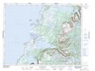
Maps showing Overfall Brook, Newfoundland and Labrador
Overfall Brook is a River located in Newfoundland and Labrador.
- Latitude: 49° 46' 29'' North (decimal: 49.774722)
- Longitude: 57° 48' 23'' West (decimal: -57.8063886)
- Topography Feature Category: River
- Geographical Feature: Brook
- Canadian Province/Territory: Newfoundland and Labrador
- Atlas of Canada Locator Map: Overfall Brook
- GPS Coordinate Locator Map: Overfall Brook Lat/Long
Overfall Brook NTS Map Sheets