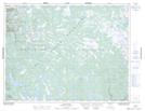
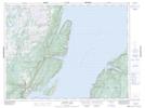
Maps showing Main River Waterway Provincial Park, Newfoundland and Labrador
Main River Waterway Provincial Park is a Conservation area located in Newfoundland and Labrador.
- Latitude: 49° 49' 31'' North (decimal: 49.8252905)
- Longitude: 57° 11' 39'' West (decimal: -57.1940678)
- Topography Feature Category: Conservation area
- Geographical Feature: Provincial Park
- Canadian Province/Territory: Newfoundland and Labrador
- Atlas of Canada Locator Map: Main River Waterway Provincial Park
- GPS Coordinate Locator Map: Main River Waterway Provincial Park Lat/Long
Main River Waterway Provincial Park NTS Map Sheets