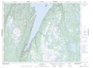
Maps showing Pollard's Point, Newfoundland and Labrador
Pollard's Point is a Unincorporated area located in Newfoundland and Labrador.
- Latitude: 49° 44' 51'' North (decimal: 49.7475)
- Longitude: 56° 53' 44'' West (decimal: -56.8955555)
- Topography Feature Category: Unincorporated area
- Geographical Feature: Local Service District
- Canadian Province/Territory: Newfoundland and Labrador
- Atlas of Canada Locator Map: Pollard's Point
- GPS Coordinate Locator Map: Pollard's Point Lat/Long